“The entire Maury River contains excellent habitat and high-density fish populations. The most common sportfish are Smallmouth Bass, Rock Bass, and Redbreast Sunfish. Other warm water species that anglers might encounter include: Green Sunfish, Fallfish, Bluegill and Largemouth Bass. The river through Goshen Pass is also stocked by DWR with Rainbow and Brown Trout between October and May” (VaDWR)
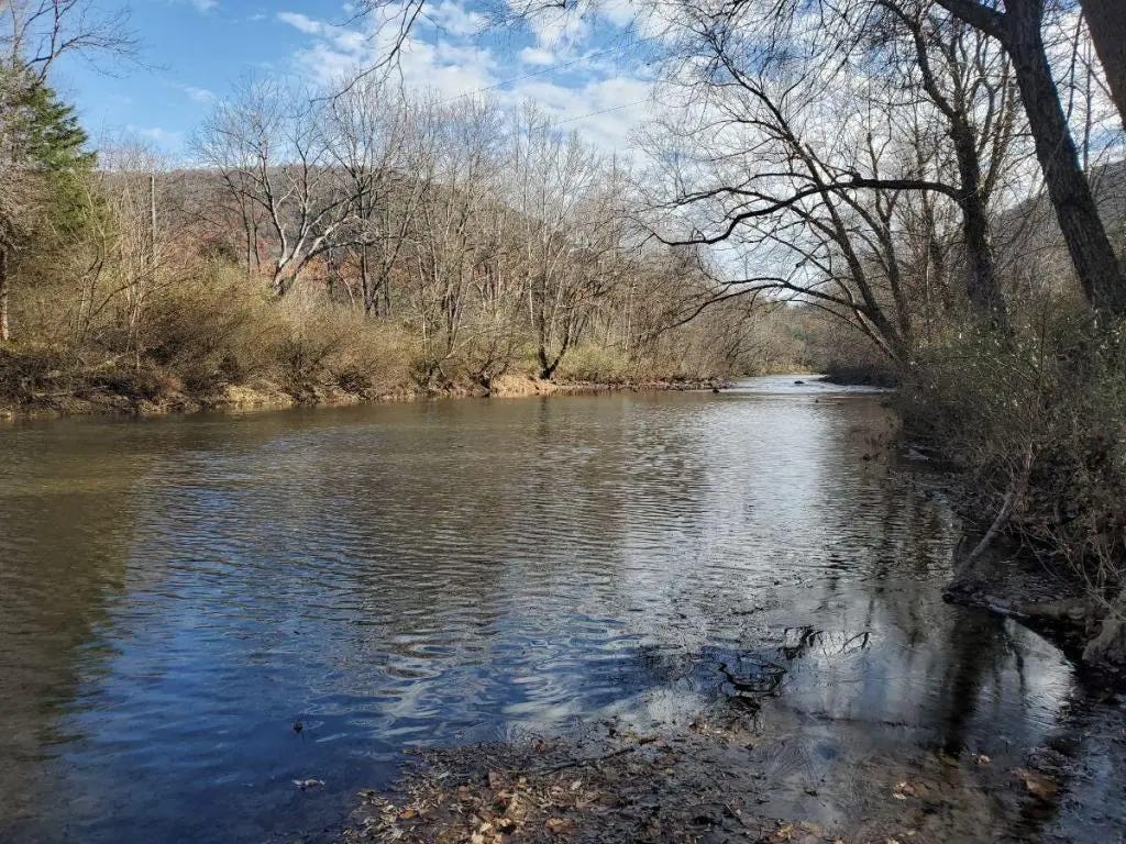
The summer after high school graduation and matriculation at Virginia Military Institute I spend basically every day on the Maury River and exploring Goshen and the river holds a special place filled with memories and great fun but also some of the most catches of bass species in a full day ever in my entire life.
The Maury is about 43 miles long and a trib of the James River watershed. When I was growing up you would still here the old timers call the Maury the “North River” or even “Calfpasture” and not Maury. That is because North River was generally the accepted name for the river until around 1945 when the legislature in Richmond officially named the river after Matthew Fontaine Maury. Most of the people that were determined to call it North River have long passed on.
The river often flows in the shadows of the James River and the Shenandoah River but in truth the river has become a wonderful habitat for bass and has created quite a following in recent years because of the large numbers of quality bass being caught. It will not be long before the state record for Rock Bass likely falls on the Maury River but the smallie population has been increasing the last two decades in terms of density. Over a decade ago Virginia DWR determined that there may be 1,500 Rock Bass per mile in the Maury.
Smallmouth populations have been growing the past few years but it is interesting to note that back in 2011 a study examined the Smallmouth and its relationship to the James River.
“We subsequently used classification functions and stock mixture analyses based on these signatures to identify the natal origins of age-1 juveniles collected from the same rivers 1 year later. The results indicate that approximately 50% of the age-1 smallmouth bass collected in the James River were spawned in the Maury River, while no evidence for reciprocal main stem-to-tributary exchange was found. These results suggest that the downstream movement and dispersal of smallmouth bass is common in their first year of life. Such inputs from tributaries may play an important role in the dynamics of smallmouth bass river fisheries, which are often characterized by substantial annual variation in recruitment. Characterizing such exchange at broader scales will probably be an important step toward linking the spatial ecology of this species with effective management and conservation strategies in river–tributary networks.” (American Fisheries Society)
Maury River Floats : (from VaDWR)
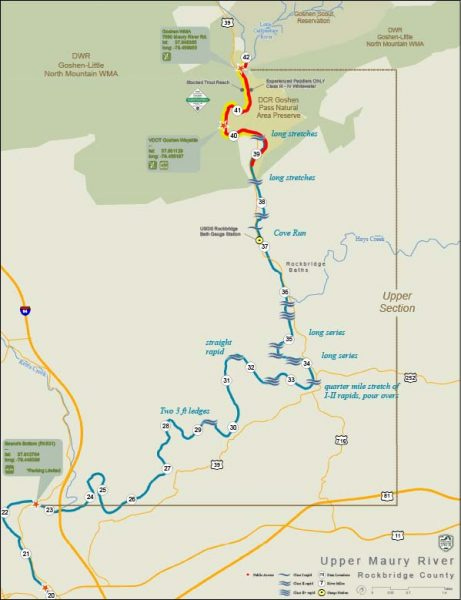
“Maury River Float Trip Information Goshen WMA to VDOT Wayside Distance: 2.5 miles -- This trip begins at the DWR access at the “swinging” bridge that crosses the river. There is a gravel parking area and gently sloping bank to access the river. CAUTION- This reach of river through the Goshen Pass contains multiple Class II-IV whitewater rapids and should only be navigated by experienced whitewater paddlers. One (100yd) stretch of Class IV rapids is known as the “Devil’s Kitchen”. Take out on river right at the VDOT wayside on Route 39. There is ample parking, picnic tables, a pavilion and portable restrooms at this location. This float offers beautiful scenery of the Goshen Pass Natural Area Preserve. Much of this section of river is stocked with hatchery trout by DWR, October-May.
Bean’s Bottom / Route 631 (Furrs Mill Road) to Jordan Point Park (Lexington) Distance: 2.5 miles -- Put in on river left on the upstream side of the bridge. You will have to carry your kayak or canoe down a fairly steep gravel path to get to the river. Parking is limited at this site and vehicles should be parked off the shoulder of Route 631 on the east side of the bridge. The one “obstacle” that paddlers should be aware of on this section is the 3 foot high Lexington Water Department Dam located just downstream of the confluence of Whistle Creek. Take out on river right at Jordan Point Park upstream of the Route 11 Bridge. There is ample parking and restrooms at the park. The park is only open sunrise to sunset.
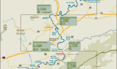
Jordan Point Park to Ben Salem Wayside Distance: 6 miles -- This is one of the more popular stretches to paddle on the Maury River. Put in at the north end of the park on river right. There is ample parking and a gentle-sloped bank to launch your boat. Remember the park closes after dark. There are also restrooms located at the entrance to the park. This section of river contains several Class I-II rapids and the remnants of a few old locks and dams leftover from the historic batteau navigation days in the mid 1800’s. At the take out (on river right) you will have to carry your boat up a steep, grassy hill about 100 yards to the road.
Ben Salem Wayside to Route 60 DWR Access Distance: 1.5 miles -- Put in at the Ben Salem Wayside along Route 60. Park your vehicle in one of two small lots or off the shoulder of Route 60. You will have to carry your boat down a steep, grassy hill about 100 yards to the river. This is a relatively short float, but the last half mile is flatwater created by Moomaw Dam 200 yards downstream of the take out point. Take out is on river left just upstream of the Route 60 Bridge. This is also a trailhead for the Chessie Nature Trail, which runs north from the parking area.
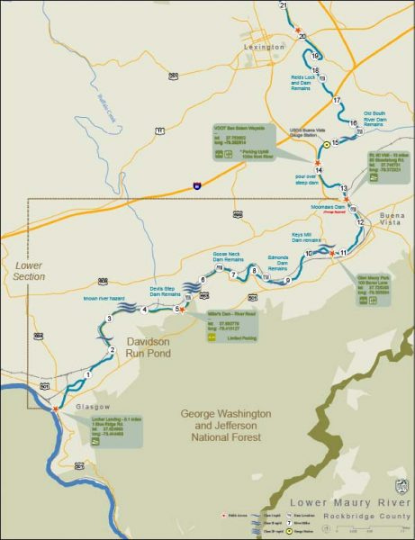
Glen Maury Park (Buena Vista) to Miller’s Dam (River Road) Distance: 7 miles -- This is a great float with lots of awesome fish habitat. There is ample parking and a grassy bank to launch canoes, kayaks, or rafts just on the upstream side (river right) of the Route 745 Bridge. There is also a handicapped-accessible concrete landing at this site. Paddlers will encounter several Class I-II+ rapids on this reach and the remains of several old dams. These old “broken” dams (Edmondson’s Dam, Goose Neck Dam, Devil’s Step Dam) contain large chunks of concrete and swift currents. Paddlers should scout the areas before running these rapids or “walk” their boats around these hazards. Take out is on river left at the remnants of Miller’s Dam (the take out is immediately upstream of the old lock). This is not an easy place to launch a canoe or kayak as the bank is steep and undeveloped. Parking is adjacent to River Road (SR 663) and limited space can only accommodate 6-8 vehicles. Due to the limited parking at Miller’s Dam, you may want to use this access primarily on weekdays.
Miller’s Dam (River Road) to Locher Landing (Glasgow) Distance: 5 miles -- This is a very mild and straightforward float. Paddlers will only encounter a few “riffles” and 2-3 Class I rapids in this reach of the lower river. Put in on river left at the remnants of Miller’s Dam (immediately upstream of the old lock). This is not an easy place to launch a canoe or kayak as the bank is steep and undeveloped. Parking is adjacent to River Road (SR 663) and limited space can only accommodate 6-8 vehicles. Take out on river right just downstream of the Route 130 Bridge. There is ample parking and a concrete ramp at Locher Landing. Due to the limited parking at Miller’s Dam, you may want to use this access primarily on weekdays.
Glen Maury Park (Buena Vista) to Locher Landing (Glasgow) Distance: 12 miles -- This is a long float and could take 6+ hours to complete, depending on the flow of the river. The first half of the trip is where you will find the best fish habitat and paddling challenges. There is ample parking and a grassy bank to launch canoes, kayaks, or rafts just on the upstream side (river right) of the Route 745 Bridge. There is also a handicapped-accessible concrete landing at this site. Paddlers will encounter several Class I-II+ rapids on this reach and the remains of several old dams. These old “broken” dams (Edmondson’s Dam, Goose Neck Dam, Devil’s Step Dam) contain large chunks of concrete and swift currents. Paddlers should scout the areas before running these rapids or “walk” their boats around these hazards. Take out on river right just downstream of the Route 130 Bridge. There is ample parking and a concrete ramp at Locher Landing. Additional River Access Points / Private Property Respect Private Property.
From the bottom of Goshen Pass near Rockbridge Baths downstream to the confluence with the James River (except for the public access points depicted on this map), both banks of the river are private property, above the average high water mark. Always ask permission from the landowner before traversing across these properties. Obtaining permission from private landowners could provide access to other reaches of the river for paddling or fishing. Safety / River Conditions High water can be dangerous. Know your limitations based on your experience level. Low water - The Maury River becomes difficult to navigate when the stream flow is <2.0 feet at the Buena Vista USGS Gage. Float time will depend on river flow and/or how much you paddle. At “normal” stream flow, the average paddler floats about 2 miles per hour Stream flow – Real-time river conditions:
Rockbridge Baths https://waterdata.usgs.gov/va/nwis/uv/?site_no=02021500&PARAmeter_cd=00065,00060,62620,62614
Buena Vista - https://waterdata.usgs.gov/va/nwis/uv/?site_no=02024000&PARAmeter_cd=00065,00060,62620,62614”
Maury River Biologists Report:
https://www.facebook.com/watch/?v=349099642427271
https://dwr.virginia.gov/wp-content/uploads/Smallmout-Bass-Mortality-Final-Rpt-VT-2009.pdf


