One of the newer kayak bass fishing series entering the tournament segment of the fishing community is the Smallie Chaser River Bassin Series which initially will cover river systems located in the Virginia, Maryland, West Virginia sub region but will be expanding to the the Pennsylvania and New York region as well.
The series is Smallmouth-Only-River Only in nature and seek to highlight the regions great smallmouth bass fishing. The Series will focus on some of the best smallmouth fisheries in the Mid Atlantic Region like the New River, Shenandoah River, Upper Potomac River and of course the James River.
The James River is widely known outside Virginia as a Largemouth Bass factory given the scheduling of the river’s tidal portion by such known organizations as B.A.S.S. with the Bassmaster Classic on the river and Major League Fishing (MLF) along with Kayak Bass Fishing (KBF) over the years but in truth the James River is an outstanding Smallmouth Bass river system stretching all the way across the Commonwealth of Virginia.
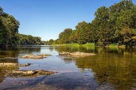
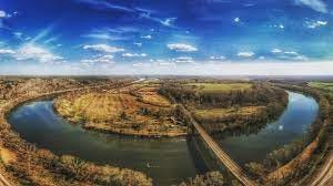
The James River flows some three hundred and fifty miles or so from the Appalachian to the Chesapeake Bay. The river is home to such historic southern destinations as Jamestown, Williamsburg and Richmond, Virginia which was built right on the James River fall line that separates the tidal portion of the river from the non tidal. The non tidal stretches from the James River headwaters confluence of the Cowpasture and Jackson Rivers all the way to Richmond fall line is home to a densely populated Smallmouth Bass population while below the fall line is more widely known for Largemouth Bass.
Richmond offers a two mile stretch above the fall line and below which is home to the only Class III up to IV rapids in existence in America within a system running through a major city.
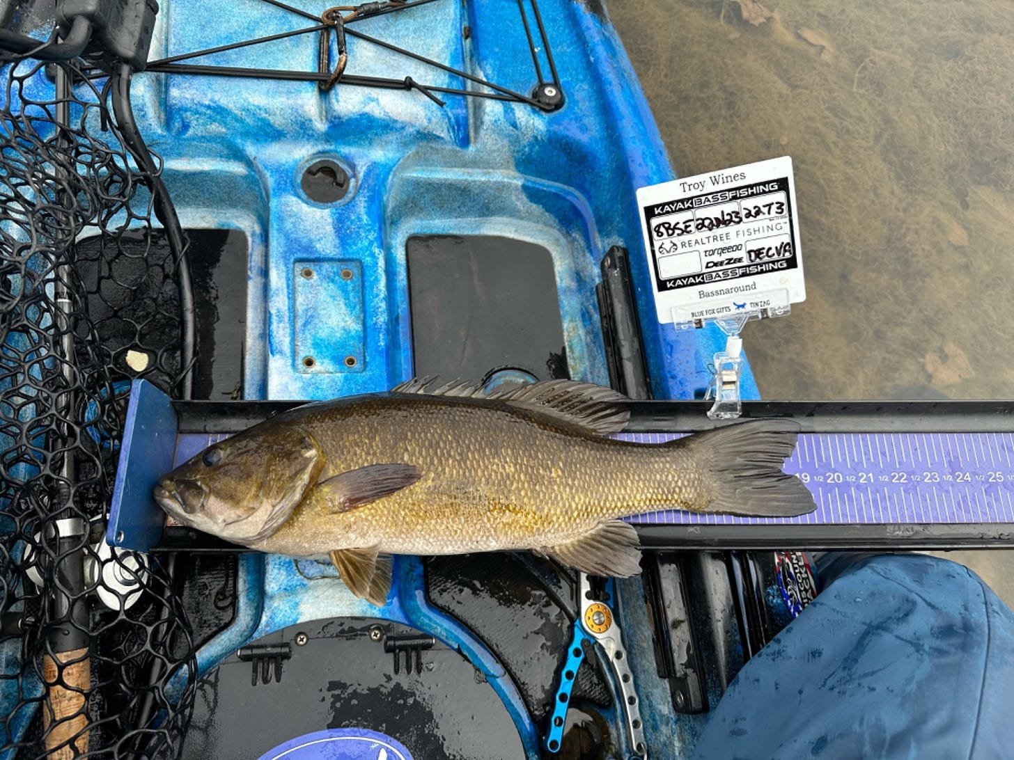
Photo Credit: Troy Wines, Smallie Chaser River Bassin Series
The journey to Richmond for Smallie Chasers however begins some four hours west at the confluence of the James River with the Cowpasture and Jackson Rivers. This is some of the most scenic and beautiful parts of Virginia that many never experience. Iron Gate below Rt 220 is the first boat ramp/access point on the Upper James River located below the confluence area. Anglers much paddle up river to take in the confluence and this can be no small feat when the river is way down so many opt to begin their Upper James River experience by heading down river.
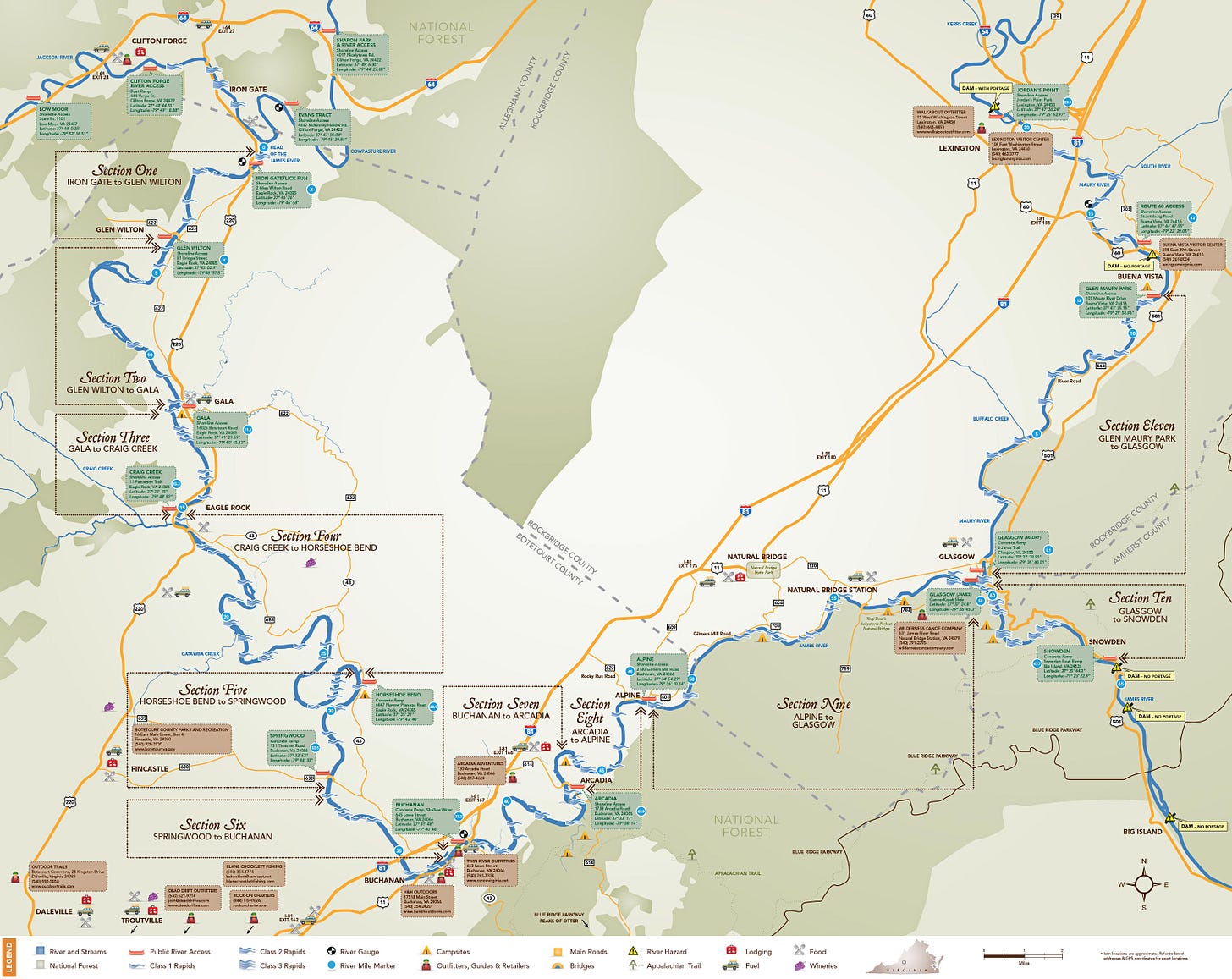
The Upper James is more or less ten sections of float trips.
Through the riffles and runs to Glen Wilton which is about 2.5 miles down river from Iron Gate the journey begins. This is a shorter run through typical Class 1 rapids with a single Class II before arriving at the bridge of Rt 622 (Glen Wilton Bridge). The mountain views of this section really all the way down to Eagle Rock are stunning and the fishing picks up the further down river as the river takes you. You will pass Lick Run and “Surprise” rapid to get your heart going early on on the way to Glen Wilton.
After moving past Glen Wilton or entering the James here at the bridge anyways paddlers will experience some great runs with areas holding smallies given the quality of the river flow and oxygen provided the smallies and before long if you are not enamored with Patterson Mountain views the river narrows a bit as it winds with Class 1 rapids and riffles before ultimately bring anglers to the area known as the “Squeeze” as the river tightens Class II and known to flip a kayak or two in its day. Glen Wilton splits the “Surprise” and “Squeeze” Class II runs.
The town of Gala is some seven and half miles from Glen Wilton below Baldwin and Haden offering river access on Sinking Creek river left which runs under Rt 220 bridge The section upcoming has one of the Twin River Outfitter campgrounds (Gala).
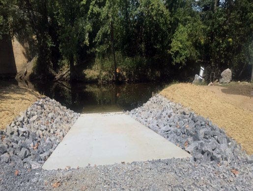
So the first leg of the journey really is about an eight hour or so run depending of course upon the water levels and current situation from Iron Gate to Gala and can certainly be done in one day. The new improved ramp is pictured here: (Credit: Roanoke Outside)
The next leg of the journey beginning in Gala will run down river to Eagle Rock. This leg is about four miles and includes plenty of swift moving water and fishing opportunities. In fact this run probably will have more anglers fishing than the previous legs thus far below the confluence or at least it always seemingly does. You will find cliff ways in this section of the river. There can be long stretches of shallow water to target smallies in and on those clear river days spotting darters and smallies from the shallows is the norm. After making your way down river from the Gala towards Eagle Rock the next major access point is access the gravel access at Craig Creek (DGIF).
From Craig Creek anglers are in for a longer float down to Horseshoe Bend (Narrow Passage). This leg is about thirteen miles long and starts with riffles and Class I’s in a set of three spread out in a field of swift running current. Much of it is a designated “Virginia Scenic River” with easy going Class I and easier Class II rapids to run. This area offers up some of the best smallmouth fishing and for many is certainly the most fun stretch from inside and outside the kayak as the river along with the endless river loops like Horseshoe Bend downriver between Salisbury and Springwood. Truly a scenic stretch and also relatively private. In fact the remains of the old James & Kanawha River Canal remnants can be seen from the river but reside on private property today.
You will experience some great scenes along the way and experience “Gwens Lock” Class II along with the islands of Catawba (Salisbury), Rocky Cliffs and Chimney Rock and Stone Piers and cliffs all along areas and turns of the river along with the Buttons Bluff Railroad bridge that will actually cross the river twice heading towards Springwood. At Horseshoe Bend at rivers turn you will find Twin River Outfitters Narrow Passage campground near the access point to James River.
(Photo Credit: Liam Kelly)
The leg from the ramp at Horseshoe Bend (Narrow Passage) to Springwood after the run from Craig Creek to Horseshoe Bend feels more like a short jog given its only about three and half miles compared to the thirteen miles of the previous leg. The river offers a bit more riffles in the run as well including some nice swift runs like Shallow Rocky Shoals and Class II’s like Ritchie’s Falls (run left when shallower) which comes up about ten minutes after launch from Horseshoe Bend with about a foot and half ledge and drop. Also experience Springwood Island along the way nearest the Springwood access point to the James.Access for take out after this shorter run can be done at the concrete ramp river left at Springwood just past the bridge area Rt. 630 or in the area offering camping areas shoreline for those making the extended journey offering some great fishing.
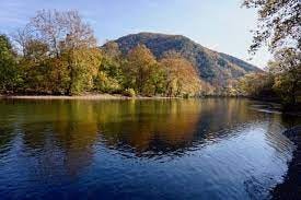
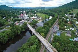
The next leg of the journey is most certainly the easiest. Popular stretch running from Springwood to Buchanan in Botecourt County, Va for beginner paddlers lasting about two hours or about five miles of river. The stretch does contain a long flat water pool stretch of about two miles as well as swift running ripples and rapids after a Class II but typically an easy run in the normal shallow water conditions that present. The views of Purgatory Mountain on left are absolutely beautiful views throughout the seasons. The run brings you under the I-81 bridge after Looney Mill Creek and onto Limestone Park and as the river turns takes you to the swinging bridge area in downtown Buchanan. (Photo credit Virginia.org) and the Twin River Outfitters Buchanan campground near Buchanan Town Park in town.
From Buchanan the next stretch is a six mile one to Arcadia ending at the bridge of Rt 614 which is a popular paddling area on the James River taking paddlers through the “Quarry Rapid” Class II just outside of town as the river turns and dives once again on the way to Arcadia. One of the more challenging sections for less experienced paddlers to be sure and area has been known to tip over many a kayak/canoe when water levels are up on the river. The James will bend again taking you to yet another Class II rapid before heading through some swift water and on to Jennings Creek and river central island. A ledge forms here and can at times offer some quality fishing when the water levels are low left side of the island. Just beyond is the Rt 614 bridge and access point for Arcadia and the Twin River Outfitters Arcadia campground before Indian Rock.
This run offers multiple small rapids offering more by the way of scenic views than quality fishing normally compared to other stretches especially the next leg which is one of the better runs for quality smallmouth throughout the run and that is the section between Arcadia and Alpine.
The Arcadia -Alpine run sometimes called the “Powerline Run” is a short four and half mile section but offers some of the best quality smallmouth fishing on balance as any other on the Upper James River and is largely more remote than previous legs. Nice island stretch to run staying right for shallower fishing and tethering wade fishing whereas left tends to be deeper around the island. It combined with portions of the run between Alpine and Glasgow have been known to register many Virginia citation smallmouth in both the Spring and Fall.
The Alpine to Glasgow float is almost twelve miles long but if you are looking for a combination of beautiful scenic views along with quality smallmouth than this float is worth the trip given you get to see all the beauty of the George Washington National Forest and offers longer stretches of flat, calm water after two Class II’s along with ledges and with pools for smallies. Duo of ledges right off the jump from the ramp at Alpine in the river center forming typically a Class II followed by another that will take paddlers on a two foot or more drop at times. Next it will be much calmer runs of some Class 1’s before Cedar Creek enters the James River from Natural Bridge.
After Cedar Creek as the river bends again paddlers experience about four or so more Class I fields of riffle and swift runs with Black Run Creek entering the James before reaching the Natural Bridge Station and Arnold Valley Bridge. Above here there are two camp sites. Jellystone and Wilderness Canoe Company. split on the river by the old dam rapid run which is a Class II.
Anglers can exit river left before the confluence of the Upper James and the Maury River. (Photo Credit: VDWR) National Forest Camping is river right opposite “Cement Tower” rapid Class II and the confluence with the Maury as it empties into the James River with a Class III run at times depending upon the current and river levels. Most times staying left through the “Cement Tower” area is typically an easier go of it.
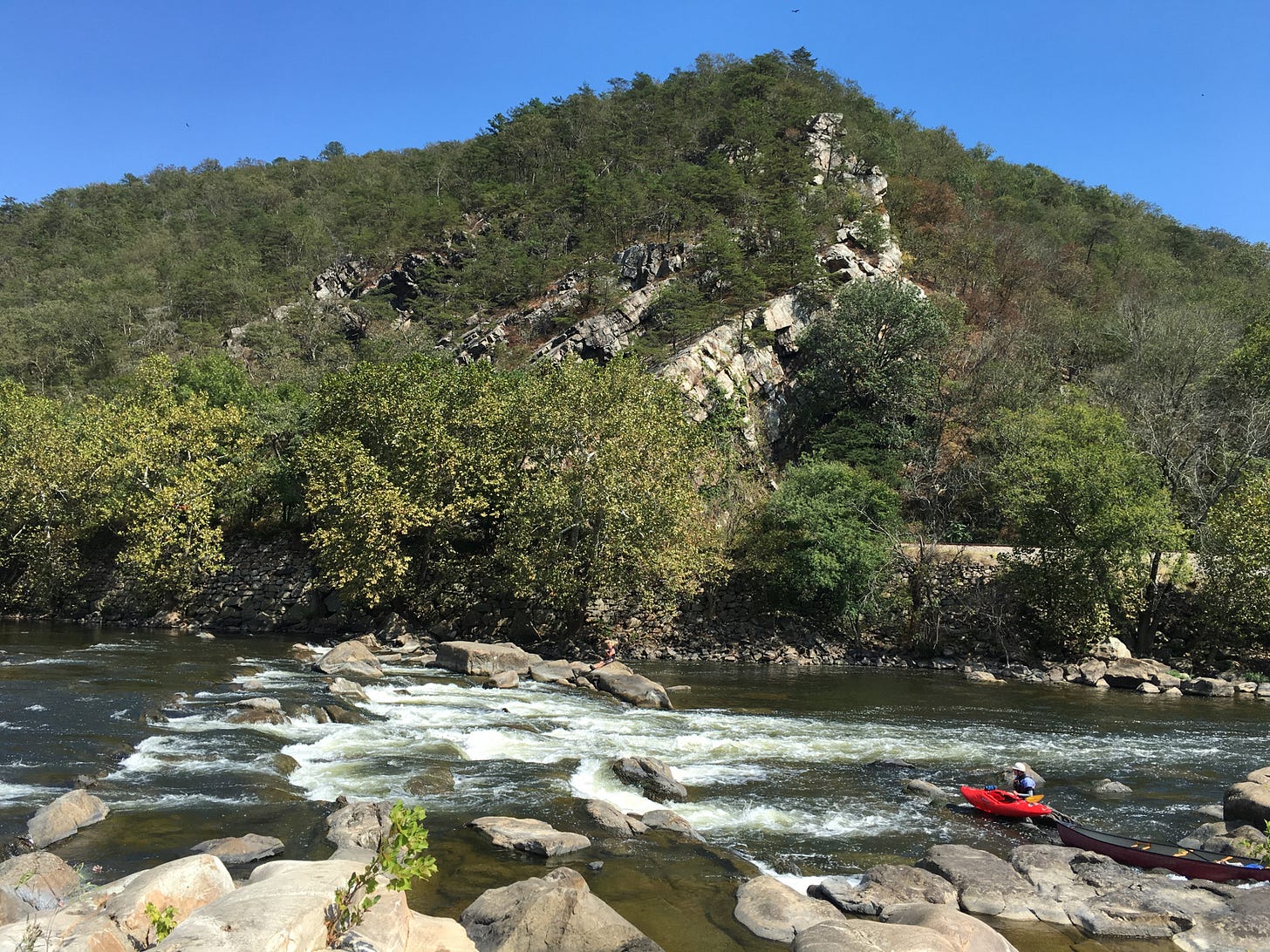
From the confluence with the Maury River the next leg is onto Snowden is the James River Gorge Section and the well known destination Balcony Falls area a popular camping destination with access only via the James River and represents probably the most challenging for paddlers from a technical perspective given it has mix of Class I, II, III which can quickly rise to IV to VI during high water event. An area just down river from the confluence begins a seventeen degree gradient per mile in the river creating whitewater challenging kayak and canoe. Stay river right with the current flow until reaching Balcony Falls and then transition over the the opposite side on left as the journey continues down river to exit.(Photo Credit r/Kayaking)
Both Balcony and Little Balcony Falls are challenging are represent the largest rapid on the river system and must be respected. Its basically a three mile stretch of whitewater. You will run through an area often referred to as the rock garden and some Class I’s leading toward Balcony Falls with smaller islands right as well as central on the way to Snowden. Camping always seemingly appears make shift in this area most due to the scenic nature of the spot and rock wall adjacent to river. Once past the whitewater a flat emerges for calm water really all the way until you see the Appalachian Trail Foot Bridge (James River Foot Bridge) & Railroad Bridge before coming to the take out/access point of Snowden/Rocky Run Access.
Beyond which will be the Cushaw Dam on the James River.
Regional River Float Series: Upper James River, Maury River, Shenandoah River, Upper Potomac River, Rappahannock/Rapidan River, New River
Map Credit:Upper James River Water Trail
Campgrounds:
Twin River Outfitters -Gala, Narrow Passage, Arcadia, Back Run
Gala campground: 80 Thompson Dr., Eagle Rock, VA 24085 (RIVER MILE MARKER 11.8)
Horseshoe Bend campground: 6869 Narrow Passage Rd., Buchanan, VA 24066 (RIVER MILE MARKER 29.1)
Arcadia campground: 1800 Arcadia Rd., Buchanan, VA 24066 (RIVER MILE MARKER 43.5)
Back Run Camping: 1019 Gilmore Mills Road, Natural Bridge Station, VA 24579.
Jelly Stone (Alpine/Glasgow)
George Washington National Forest
Join and Follow Us Here:
Smallie Chaser River Bassin Group: https://www.facebook.com/groups/885248796934955
Smallmouth Army Group: https://www.facebook.com/groups/1322144201945490
Smallie Chaser River Bassin Series: https://www.facebook.com/profile.php?id=61553134117540


