Juniata River, PA
Regional River Float Series
We often see at times with river systems that are really good rivers providing outstanding Smallmouth Bass fishing often be overlooked or even ignored largely due to the fact an adjacent river in the case of the Juniata River is as popular with tournaments for bass anglers as the the might Susquehanna River.
My father grew up in Lewisburg, PA and it was not uncommon for us to hit the Juniata River in large part because it was often less pressured than the North Branch of the Susquehanna River adjacent to Lewisburg some years ago.
The Juniata River River Valley has been named Top Spring Fishing Destination in the United States by FishingBooker. The Juniata River is the second longest tributary of the Susquehanna River where you will find it entering about fifteen miles north of Harrisburg, Pennsylvania.
Many tournament anglers may be familiar with this area as it is in the lower end of the normal boundaries for major national kayak bass fishing events on the Susquehanna that run from Sunbury to Harrisburg over the last few years sponsored by Hobie and Bassmaster. The confluence at Clarks Ferry bridge area where Rt 22 crosses the Susquehanna just above Duncannon is probably most familiar with anglers where the Juniata meets the Susquehanna River.
The Juniata River was always a great place to chase Smallies in Pennsylvania when I was young and still holds every bit as much a place in my heart as the North Branch Susquehanna River. It was always funny as a kid growing up that there was a Lewisburg on the Susquehanna and a Lewistown on the Juniata River. The river today is probably even better than it was back in the day when I was growing up and visiting Pennsylvania with family.
The Juniata River located in Central Pennsylvania is an integral part of the Juniata River Valley which bears its name as the river that flows through Huntingdon County and Perry County to the Susquehanna River confluence. During the Spring the river can rival other popular destinations like Penn Creek or the Susquehanna River. Like many other river systems, the Juniata was used by many Native American tribes as a means for transportation or as a “highway” if you will long before roads were ever cut out of the rich woodlands of the Juniata River Valley. The valley was home to the OnoJutta-Haga as well as having a history of the Lenni Lenape “Original People” or the Delaware before the tribe was pushed further to the west during the colonization period in Pennsylvania.
The Juniata originates in the mountain terrain of the Allegheny Front some 3,000 miles above sea level before traversing through Central Pennsylvania to less than than 350 feet above sea level and has three major tributaries of its own including Raystown Branch, Frankstown Branch, and Little Juniata.
The Valley often referred by many as “Big Valley” is home to one of the largest populations of Amish and Mennonite communities in the United States and littered with welcoming small towns and a rural feel from farms that surround the towns. The “Narrows” not to be confused with the Virginia river location bearing the same name offers a dramatic scenic river experience of the Juniata for any traveler to the Valley and stretches almost ten miles and for the most part remain relatively shallow throughout the year creating memorable fishing adventures for those chasing Smallmouth Bass.
The river has the luxury of being fed by some of the best spring-fed streams throughout its length across much of Central Pennsylvania. Thus the river is also known and to some even more so for trout fishing as the areas creeks are often stocked with trout species. You may often here references to “Big J” and “Little J” when referencing the Juniata River. The “Little J” is a cold water tributary of the Juniata.
The widest and deepest area of the Juniata River is closest to the confluence with the Susquehanna River and is not unusual to hold Smallmouth entering the river often as escape from the conditions of the Susquehanna throughout the year. The water or current flows peak period tends to be Spring so float times are swifter and faster during this period than say the summer overall.
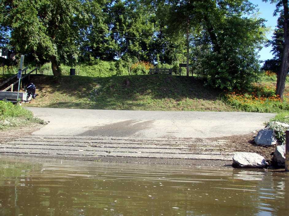
There are about (14) or more established (surfaced) or primitive access locations offering ramps or access to the Juniata
River stretches as far up river as Warriors Ridge at Rt. 305 to Amity Hall which is the last access point before the Juniata River empties into the Susquehanna River. That being said there are also various smaller access areas on the river that can be utilized that may not be as well known as well.
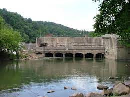
Warrior Ridge Dam (above) creates an almost two miles of “slackwater” below the dam and great water in almost remote like conditions with no roads or railroad tracks that other sections have on the river. The shoreline is heavily wooded right from the jump after steep rocky areas full of boulders. The river is relatively easy going but there can be some swift water and you will approach the wetland area along the river before approaching the Portstown Park access on the left near Huntingdon, PA and some rapids near small island before town and further access at above Standing Stone Creek on river right at the Smithfield Riverside Park (surfaced ramp access -PFBC) on 4th Street and Pennsylvania Avenue.
After Huntingdon the scenery changes a bit as the mountain valley scenes come into play with roads and railways cut through the passes and along the Juniata as you journey down river to the next access point at Juniata Point which also is where the Raystown Branch tributary enters the Juniata River river right. The Point access is surfaced as well and is another PFBC maintained access ramp like many throughout this section of the Juniata.
The stretch of small towns begins after passing through Huntingdon and the confluence of the Raystown Branch with the Juniata moving toward Mill Creek where some of the most popular smallmouth fishing exists in the upper Juniata. Some more island areas below the turn with the middle larger being private property just above the rapids formed by sandstone areas after which further down you come to the first real area of caution for paddlers above the railroad bridge and the town of Mapleton. Rt 22 basically parallels the river from Mill Creek along the descent to Lucy Furnance and along the well known “Jack Narrows” section which constitutes about two miles of river pool after town of Mapleton access point at Riverside Park (PFBC- surfaced) near Rt 655 bridge river left and the town of Mt. Union/Lacy Furnace. The popular Thousand Steps Standing Stone Trail is parallel to the river on river left in this section and well known throughout the region as a destination trail.
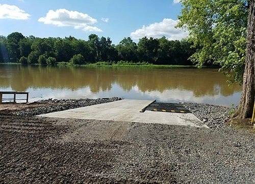
The Mapleton Riverside Park access is one of the newer access points on the Juniata and has a floating boat launch and fishing platform and shelters. This launch access is three miles from the town of Mt. Union and the its own Riverside Park access which offers access for motorized and non motorized boats. These two access points basically book end the mountain gap of Jack Narrows on the Juniata water trail.
As the Juniata turns at Mapleton to the left a bit and runs to Mt. Union the railroad line running before approaching a larger island before Rt 747 and the Rt 22/522 bridges before the river takes a sharp turn right and heads south towards the railroad bridge above Kistler. The Mt. Union access is after the turn and along Rt 22 between the turn and Kistler.
Once passing the Mt Union access point the river descends to Kistler and once again flow under yet another railroad bridge before passing through the town area where you will pass the first real repeated stretch of larger islands in the Juniata. The first one is public but the next larger one is private followed by another public one tighter to the right side bank right before the river twists a bit to the left before twisting right again to come upon the next larger island before you see the Aughwick Creek area. Its public but the one directly behind it is private . The river here in this stretch does about a one eighty forming a loop heading down into Mifflin County adjacent to the Tuscarora State Forest onto to Newton Hamilton. The Shawmut access is part of the State Forest on river right and is a surfaced ramp area right in the middle of the loop being formed below Newton Hamilton.
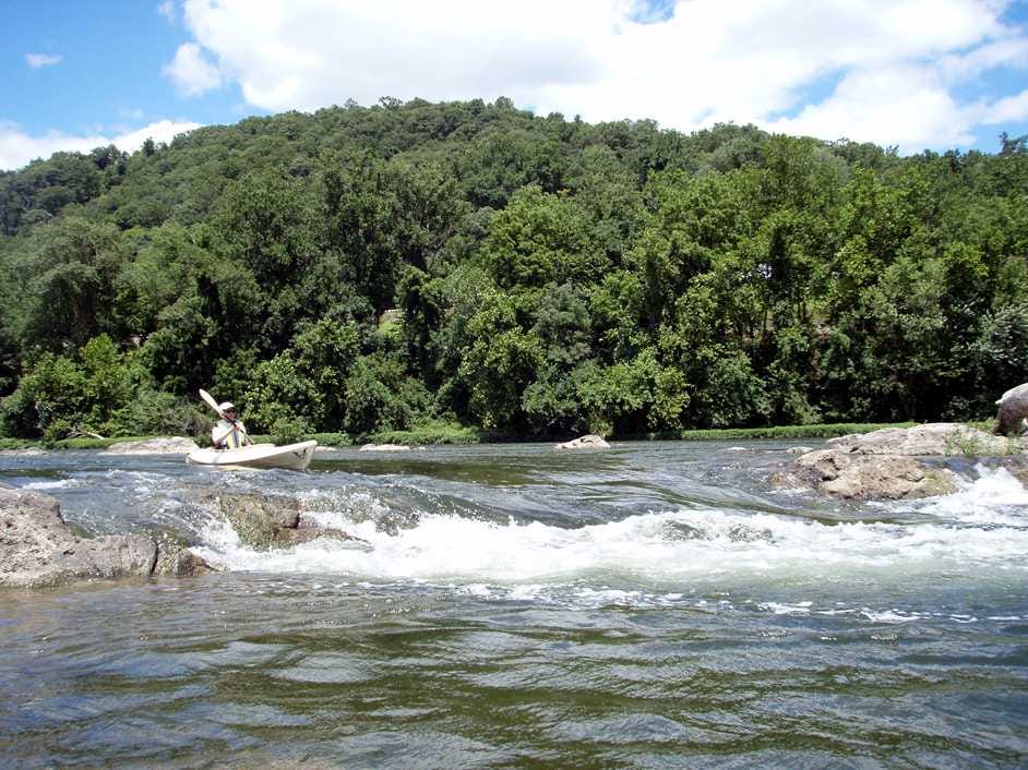
One of the camping areas is river left as you approach Newton Hamilton after you pick up a little speed through the riffle and rapids above Shawmut but below Newton Hamilton after the river completes its loop and straightens a bit before this time beginning to loop right at town where the access point is located on river right . Newton-Hamilton access is PFBC and a concrete ramp and the next rapid is just beyond the access point. Many contend this stretch from Shawmut to Newton Hamilton Access can be the most daunting of all the rapids in the float in this area as the river drops a bit from the rivers ledge.
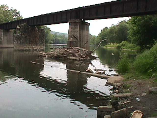
As the river completes its loop after the rapids it will turn left again with an island (public) river right then run back to the railroad as it rejoins the river left until it cross the Juniata once again downriver on the the way to McVeytown a little over half way from the Newton-Hamilton access to the town. The railroad bridge is one of the more scenic ones to be sure on the leg and worth some pictures as it sets up with mountains in the back drop but is an area to approach with caution at times. The next ones will be down river in the Lewistown area where the railroad crosses twice with identical style bridges.
McVeytown offers another camping site with restrooms river left staying left of the private island adjacent to town on river right after which the journey is more remote meandering through the rural area with tons of forest and woodland and the only thing really present is the railroad now river right as it tightens to the river and then pulls away only to return to it once again frequently. After what will be probably the longest stretch time wise between points the next access will approach on river right just passed the first of the two railroad bridges at Granville- PFBC which offers a surfaced ramp about three miles west of town of Lewistown.
There is another camping site just down from the access on river left between the two bridges. (See Locust Campground). Just past the second bridge as the river turns right Lewistown is straight away with another access point river left right in Victory Park off Rt 22. In this area the railway splits with line moving across and north while another runs along the Juniata on river right down river.
One of the favorite stretches comes up as the river moves through the valley formed by two mountains in the area known to many as the Lewistown Narrows on the way to the next access point which is river left at bearing the Lewistown Narrows designation which is a PFBC surfaced ramp access area. Its worth a stop if you need a break on the journey because it offers some sites like the lock tenders house and the canal as well as a trail and museum.
As you continue you enter stretches with far more access than previous sections between Lewistown and Newport, PA. There are some eight different access points in the entire area along the Juniata as the river runs through Mifflin, Port Royal and Millertown.
Mifflintown Access is the first one you will come to past the Narrows and it is a surfaced access area maintained by PFBC as well on the river left above the big island (private) between it and Mifflin Access river right which is surfaced but not maintained by PFBC.(Pic Credit Crownover.com)
(Pic Credit- Crownover.com)
As you continue you enter stretches with far more access than previous sections between Lewistown and Newport, PA. There are some eight different access points in the entire area along the Juniata as the river runs through Mifflin, Port Royal and Millerstown. The trek from Victory Park in Lewistown to Walkers Access is about sixteen miles or so with many access points between from Narrows to Mifflin/Mifflintown and Port Royal.
Mifflintown Access is the first one you will come to past the Narrows and it is a surfaced access area maintained by PFBC as well on the river left above the big island (private)known as Bell Island between it and Mifflin Access river right which is surfaced but not maintained by PFBC. Rt 35 crosses the Juniata River here but there have also been improvements like pedestrian bridge also projects connected the two towns separated by the river in Mifflin and Mifflintown. (Mifflin Ramp from Crownover.com)
The next two access points are much closer by than most once you get passed the rapids below Mifflin and where the Tuscarora Creek enters the Juniata river right at Port Royal. There is plenty of camping river left as well as the Walker Access -PFBC surfaced ramp. This is a big Juniata River outfitter area haunt for trips on the river and not too far down river is the Muskrat Springs Access also PFBC maintained with a surfaced ramp on river left about two and half miles or so from Walker in area called Village of Center or Locust Run. PFBC also has a hatchery on river right called Vandyke Hatchery.
From Muskrat Springs the river remains straight in its path to Thompsontown Access with access point river left maintained by PFBC with a surfaced ramp . Rt 33 crosses the Juniata in Thompsontown and the access is just past bridge. After which you will split some islands middle river and make a turn right towards Millerstown. Island camping is an option in this leg for those that want to spend an overnight or simply just put up for a bit for lunch.
Millerstown Community Park access quickly comes up after you move under Rt 17 bridge in Millerstown but is nominal really but the PFBC maintained Greenwood Acces on river left is not far from the park. Greenwood is about two and half miles south of Millerstown. It is below Wrights Run but on the opposite side of the river. The next three access points on the journey are not maintained points and are considered to be primitive by all accounts located at Newport ,Howe Township and Green Valley though the latter is actually surfaced. Newport access is river left while the other two are river right. (Newport Bridge- Elaine Deutsch)
MIllerstown to Newport is about five miles. Below Newport the Juniata loops again left with some rapids in the turn before breaking back right then left to the Howe Township access where there is also camping nearby. Down river from Newport is a ledge known as “Iroquois Falls” shown here:
The Green Valley access and campground as well as the Howe Township access are river left above the “Rock Garden” area of the river between Newport and Duncannon just as the river begins its descent to the confluence with the Susquehanna River as it picks up momentum and often is very swift with faster current than areas above. The Green Valley access is surfaced and is the last real access point on the Juniata River before Amity Hall river left above Duncannon. (Howe Township- PFBC below)
Typically Amity Hall is the western boundary for fishing Susquehanna River events as the furthest most point you can fish in events held on the Susky when they allow anglers to fish the tributaries or major rivers. These events have included the Hobie Bass Open Series and the Bassmaster Kayak Series Opens in the past. It is the last ramp before confluence with the Susquehanna River.
Forage Species & Habitat:
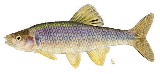
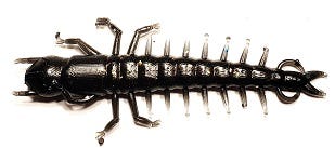
The forage of the Juniata watershed is chop full of Hellgrammites, Crayfish and Minnows but there are others like the Nymph that is a predominate prey of the the smallies in the river. The sections of the river offer some didffering desnity levels of the forage from Mimic Shiner to Spotfin Shiner as well as the White Sucker for bass and other species to prey on for forage.
Crayfish in the Juniata native specie wise are under attack and there are some reports of hybrids now populating the river watershed as crosses between the Rusty Crayfish an invasive specie moving in from the west into the Juniata and Susquehanna River with the Allegheny specie. Neither specie are native to the Juniata River where the native Common Crayfish or Appalachian Crayfish is under pressure.
The Bluntnose Minnow is also a present in the system but so to are sculpins, dace, as well as other common shiner species. The common shiner is thought to be the most versatile of all the shiners in how it adapts as well as spawns in the river system. Locating sand and gravel is often a great clue in the Spring because many of the forage species prefer it so you will most likely find smallies as well nearby especially of these areas are located near rock and free flowing current or seams of the channel.
The Juniata is fortunate to be fed by many streams and creeks and the composition of these mirrors many areas of the river itself in terms of limestone, sandstone, siltstone and shale. many of these streams and creeks are located in Mifflin and Juniata County to explore especially for those that enjoy trout fishing as some of them are some of the best in Pennsylvania. Creeks like the Tuscarora and the West Branch Mahantango while both having trout populations also have smallies and . The Tuscarora also will have some rock bass as well and the forage is typical of a stream in a sense with caddis, mayflies in addition to crayfish and minnows.
Flies, Ned rigs, Hair Jigs, and Popping Bugs are always effective on the Juniata seemingly and over time little has change even with the introducing of more and more topwater baits coming to broader market for anglers. If you have ever been on the river during the Mayfly or White Fly season you know what I mean. This usually begins in the Susquehanna River really and makes it way west via the Juniata during the summer and the only potential rival may be the darn cicada drop. Snagler Tackle Co. who guides on the Juniata and Susquehanna River have a great selection of jigs and spinnerbaits for the river.
The sizes of jigs and spinnerbaits for the Juniata tend to be smaller than say the Susquehanna at least seemingly based on catch rates and the size of forage within the river system. You still can’t go wrong with the old Beetle Spin or the lineup of Top Spins and SwimX/FlashX spinners from 1st Gen Fishing where there compactness and blade action in the water column are perfect for the river.
Safety- As with any Pennsylvania has its own state regulations pertaining to kayak adventuring and kayak fishing out on the river so be sure to check out the regulations before you venture out on the river. The main ones to think about in terms of preparation before you go or pack out for your adventure are:
Anyone in a kayak must have an approved U.S. Coast Guard life jacket AND sound producing whistle
Any kayak on the river after dusk MUST have a white light or hand held or installed device to alert others on the water of your location..
Pennsylvania Fish and Boat Commission launches require a permit
Popular Juniata River Campgrounds:
Buttonwood Campground (Miffletown, PA) 717-436-8334
Waterside Campground (Lewsitown, PA) 717-248-3974
Two State Forests offering Camping along the Juniata River or tributaries are Rothrock on the Little Juniata and Tuscarora below Aughwick Creek.
**Many of the islands in the middle of the Juniata River are public lands and are open for camping
Smallie Chaser River Bassin Series:
https://www.facebook.com/profile.php?id=61553134117540


